What does Point Cloud mean?
One Point Cloud (German: Punktwolke) is a collection of data points in a three-dimensional space. Each point has coordinates (X, Y, Z) and can contain additional information such as color or intensity. Point clouds are usually created using 3D scanning methods such as Laser scanning (LiDAR) or Photogrammetry and precisely depict the geometric structure of objects and environments.
How is a Point Cloud created?
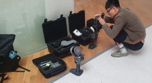
Laser scanning (LiDAR)
In the LiDAR method, a sensor emits laser pulses that are reflected by surfaces. The distance to the object is calculated from the transit time of the light pulses. This creates millions of precise measuring points in a short space of time.
Photogrammetry
This involves taking several photos of an object from different angles. Software uses triangulation to calculate the spatial coordinates of the recognized points from these images.
What are point clouds used for?
Architecture & Construction: Inventory, planning basis, documentation
Industry & ManufacturingQuality control, actual/target comparisons with CAD models
Autonomous driving & GISEnvironment modeling, navigation
Importance of LiDAR data for point clouds and their role in Gaussian splatting
A particularly important use case for point clouds is the use of LiDAR scanners (Light Detection and Ranging). These sensors record millions of measuring points by emitting laser pulses and generate high-precision point clouds that are also suitable for dynamic environments. LiDAR systems are used in areas such as autonomous vehicles, monument preservation and construction.
LiDAR data offers a particularly high spatial resolution and accuracyas they are not dependent on optical image data. Point clouds from LiDAR scans often contain intensity and colour values in addition to the XYZ position, which makes them the ideal basis for modern visualization methods.
A particularly up-to-date technique for the real-time visualization of such point clouds is the so-called Gaussian splatting. Each point in the Point Cloud is not interpreted as a discrete pixel, but as a spatially distributed Gaussian blob (Splatt). This method allows complex 3D structures to be visualized realistically without complex meshing or texturing - with high performance in real-time applications.
Especially for LiDAR-based point clouds Gaussian splatting is a promising approach, as it can handle large, unstructured amounts of data and still achieve a photorealistic representation. For example, research and real-time VR/AR applications are working on efficiently integrating scan data directly into immersive environments using Gaussian splatting - without prior conversion into polygon structures.
Further processing of point clouds
The raw point clouds are often filtered, registered (composed of different scans), classified and meshed. Algorithms such as ICP (Iterative Closest Point) or Delaunay triangulation for use. The aim is usually to create 3D models for CAD, BIM or simulations.